DJI Mavic 3 Enterprise (incl. 12 months DJI Care Enterprise Basic, 1x maintenance)
Category: Drones
DJI Mavic 3E
Enterprise Series / Industrial Drones
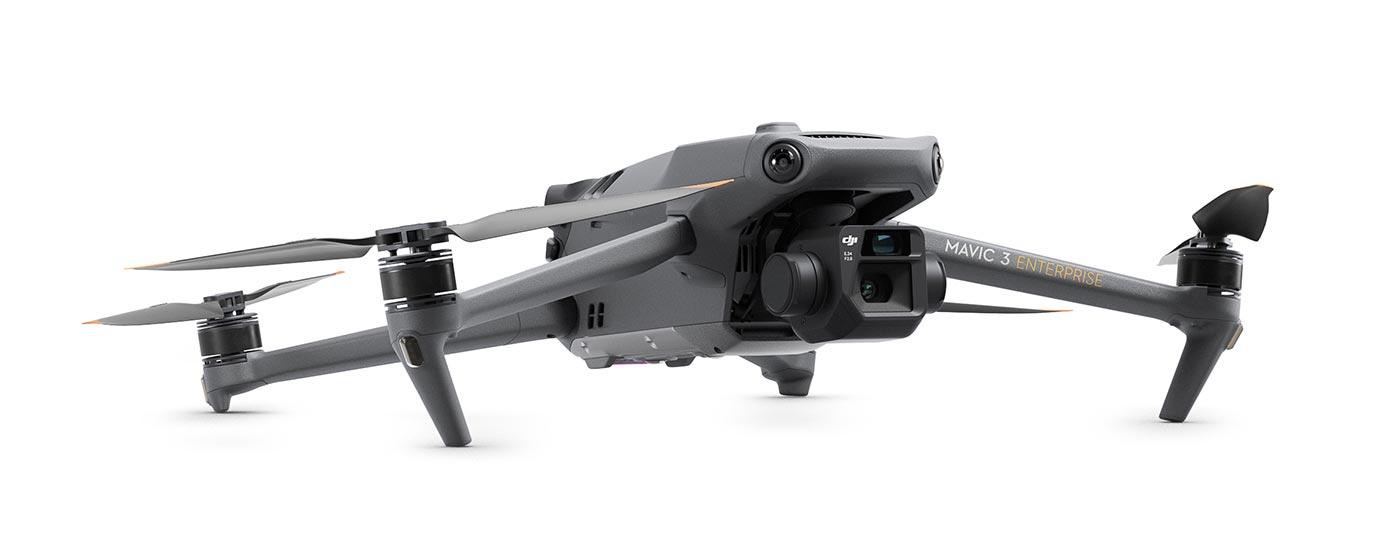
The DJI Mavic 3 Enterprise redefines industry standards for small commercial drones. With a mechanical shutter, 56x zoom camera and RTK module for centimetre-level precision, the DJI Mavic 3E takes mission efficiency to a new level. A thermal imaging camera version is also available, ideal for firefighters, rescue teams, inspections and night operations.
Price: 3.460,00 €
Prices incl. VAT plus shipping costs
(Recommended retail price: 4.349,00 €)
Do you have questions about this item or would you like to order it?
Key Features
- 4/3″ CMOS sensor wide-angle camera with 20 megapixels
- Mechanical closure
- Telephoto camera with 56x hybrid zoom
- Tele: Equivalent focal length 162 mm, 12 MP, 56× hybrid zoom
Possible areas of application
- Survey
- Inspections
- Power Generation
- Construction
Compact and handy
The streamlined and compact Mavic 3 Enterprise series can be carried in one hand and deployed in no time. It is perfect for both beginners and experienced pilots and is designed for long missions.
Quick survey
The Mavic 3E’s 4/3 CMOS 20MP wide-angle sensor features a mechanical shutter to prevent motion blur and supports fast 0.7 second interval shooting. Conduct mapping missions with exceptional efficiency without the need for a Ground Control Point (GCP).
Improved low-light performance
The Mavic 3E’s wide-angle camera features large 3.3μm pixels, which together with the intelligent night scene mode offer significantly improved low-light performance.
Focus and find
Both the Mavic 3E and Mavic 3T are equipped with a 12MP zoom camera that supports up to 56x hybrid zoom to see important details from a distance.
Make the invisible visible
The Mavic 3T’s thermal imaging camera has a resolution of 640×512 and supports spot and surface temperature measurements, temperature alerts, color palettes and isotherms to help you make faster decisions.
Synchronized split-screen zoom
The Mavic 3T’s thermal and zoom cameras support 14x continuous and simultaneous zoom for easy comparisons.
Batteries with endurance
With a flight time of 45 minutes, you can cover larger areas on each mission and survey up to 2 square kilometers in a single flight. Charge batteries quickly with the 100W charging station or directly from the drone with 88W.
Next generation image transmission
The four antennas of the O3 Enterprise transmission enable more stable connections in numerous complex environments.
Omnidirectional detection for safe flying
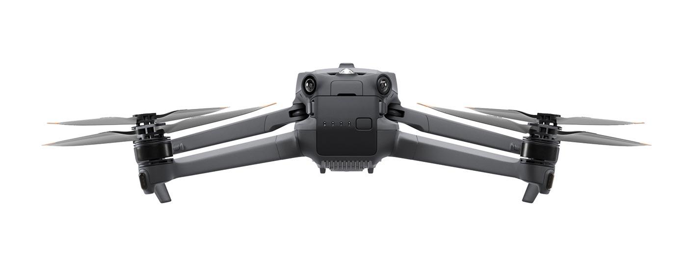
Equipped with wide-angle lenses on all sides for omnidirectional obstacle avoidance with no blind spots. Collision warnings and braking distances can be adjusted depending on the application requirements.
The improved return automatically plans the optimal route back to the starting point, saving power and time and avoiding nasty surprises.
APAS 5.0 enables automatic rerouting around obstacles so you can fly with peace of mind.
Quick survey
The Mavic 3E’s 4/3 CMOS 20MP wide-angle sensor features a mechanical shutter to prevent motion blur and supports fast 0.7 second interval shooting. Conduct mapping missions with exceptional efficiency without the need for a Ground Control Point (GCP).
Improved low-light performance
The Mavic 3E’s wide-angle camera features large 3.3μm pixels, which together with the intelligent night scene mode offer significantly improved low-light performance.
Focus and find
Both the Mavic 3E and Mavic 3T are equipped with a 12MP zoom camera that supports up to 56x hybrid zoom to see important details from a distance.
Make the invisible visible
The Mavic 3T’s thermal imaging camera has a resolution of 640×512 and supports spot and surface temperature measurements, temperature alerts, color palettes and isotherms to help you make faster decisions.
Synchronized split-screen zoom
The Mavic 3T’s thermal and zoom cameras support 14x continuous and simultaneous zoom for easy comparisons.
Batteries with endurance
With a flight time of 45 minutes, you can cover larger areas on each mission and survey up to 2 square kilometres in a single flight.
45 mins
Max flight time
2km2
Survey area per flight
Charge batteries quickly with the 100W charging station or directly from the drone with 88W.
100W
battery charging station
88W
Aircraft
Next generation image transmission
The four antennas of the O3 Enterprise transmission enable more stable connections in numerous complex environments.
Flight route
Intelligent oblique images
Increase the efficiency of your missions with smart tilt shots. During flight, the gimbal automatically moves in three directions: tilted forward, vertically down and tilted back. With just two flights, photos can be collected from all the angles needed for highly accurate 3D modelling.
Live operation recording
Record mission parameters such as flight motion, gimbal orientation, photo capture and zoom level to create templates for future automated flights.
Corridor deployment planning
Create automated aerial surveys of highways, rivers, oil pipelines and more with Corridor Deployment. Simply draw a line on the map and the area is divided into mappable segments for easy surveying.
General technical data:
Aircraft
| Weight (with propellers, without accessories) | 915g |
| Max. Starting Weight | 1,050g |
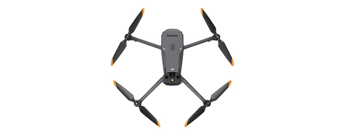
| Dimensions | Folded (without propellers): 221 × 96.3 × 90.3 mm (L×W×H) Unfolded (without propellers): 347.5 × 283 × 107.7 mm (L×W×H) |
| Diagonal Length | 380.1mm |
| Max. rate of climb | 6 m/s (normal mode) 8 m/s (sport mode) |
| Max. rate of descent | 6 m/s (normal mode) 6 m/s (sport mode) |
| Maximum speed (NHN, no wind) | 15 m/s (normal mode) Forward: 21 m/s, sideways: 20 m/s, backward: 19 m/s (sport mode) |
| Max. Wind Resistance | 12 m/s |
| Max. Start altitude above NHN | 6,000 m (without payload) |
| Max. Flight time (if there is no wind) | 45 mins |
| Max. Hover time (when there is no wind) | 38 mins |
| Max. Flight distance | 32km |
| Max. pitch angle | 30° (normal mode) 35° (sport mode) |
| Max. Angular Velocity | 200°/s |
| GNSS | GPS + Galileo + BeiDou + GLONASS (GLONASS is only supported if RTK module is enabled) |
| Hover Accuracy | Vertical: ±0.1 m (with vision sensors); ±0.5m (with GNSS); ±0.1m (with RTK) Horizontal: ±0.3 m (with vision sensors); ±0.5m (with high-precision positioning system); ±0.1m (with RTK) |
| Operating Temperature | -10°C to 40°C |
| Internal Storage | - |
| Engine Model | 2008 |
| Propeller type | 9453F Enterprise Propeller |
| Signal light | Integrated into aircraft |
Wide-angle camera
| Sensor | DJI Mavic 3E: 4/3 CMOS; effective pixels: 20 MP |
| Lens |
|
| ISO | 100 to 6400 |
| shutter speed | Electronic shutter: 8 to 1/8000 s Mechanical shutter: 8 to 1/2000 s |
| Maximum image size | 5280×3956 |
| Photo modes |
|
| Video Resolution | H.264 4K: 3840×2160 at 30 fps FHD: 1920×1080 at 30 fps |
| Bitrate | 4K: 130Mbps FHD: 70Mbps |
| Supported file formats | exFAT |
| Photo Format | JPEG/DNG (RAW) |
| Video Format | MP4 (MPEG‑4 AVC/H.264) |
Telecam
| Sensor | 1/2″ CMOS, effective pixels: 12 MP |
| Lens | Field of View: 15° Equivalent focal length: 162mm Aperture: f/4.4 Focus: 3m to ∞ |
| ISO | 100 to 6400 |
| shutter speed | Electronic shutter: 8 to 1/8000 s |
| Maximum image size | 4000×3000 |
| Photo Format | JPEG |
| Video Format | MP4 (MPEG‑4 AVC/H.264) |
| Photo modes |
|
| Video Resolution | H.264 4K: 3840×2160 at 30 fps FHD: 1920×1080 at 30 fps |
| Bitrate | 4K: 130Mbps FHD: 70Mbps |
| digital zoom | 8x (56x hybrid zoom) |
Thermal imaging camera
| Sensor | Vox Uncooled Microbolometer |
| pixel pitch | 12μm |
| frame rate | 30Hz |
| Lens | Diagonal field of view: 61° Equivalent focal length: 40mm Aperture: f/1.0 Focus: 5m to ∞ |
| Sensitivity | ≤50 mk at f/1.1 |
| Temperature measurement method | Point measurement, area measurement |
| Temperature measurement range | High gain mode: ‑20°C to 150°C Low gain mode: 0°C to 500°C |
| Palette | White Hot/ Black Hot/ Tint/ Iron Red/ Hot Iron/ Arctic/ Medicinal/ Fulgurite/ Rainbow 1/ Rainbow 2 |
| Photo Format | JPEG (8 bit) R‑JPEG (16-bit) |
| Video Resolution | 640×512 at 30 fps |
| Bitrate | 6 Mbps |
| Video Format | MP4 (MPEG‑4 AVC/H.264) |
| digital zoom | 28x |
| Infrared wavelength | 8 to 14 μm |
| Infrared temperature measurement accuracy | ±2 °C or ±2% (whichever is larger) |
Gimbal
| Stabilization System | 3‑axis (tilt, roll, pan) |
| Mechanical Area | Tilt: ‑135° to 100° Roll: ‑45° to 45° Pan: ‑27° to 27° |
| Controllable Area | Tilt: ‑90° to 35° Pan: Uncontrollable |
| Max. Steer Speed (Tilt) | 100°/s |
| Angular vibration range | ±0.007° |
Video transmission
| Video transmission system | DJI O3 Enterprise Broadcast |
| Live view quality | Remote control: 1080p/30fps |
| Operating Frequency | 2.400 to 2.4835GHz 5.725 to 5.850GHz |
| Max. Transmission range (without obstacles and interference) | FCC: 15m CE: 8 km SRRC: 8 km MIC: 8 km |
| Max. Transmission range (with obstacles) | Strong interference (e.g. dense development, residential areas): 1.5 to 3 km (FCC/CE/SRRC/MIC). Medium interference (e.g. suburbs, city parks): 3–9 km (FCC), 3–6 km (CE/SRRC/MIC). Low interference (e.g. open space, remote area): 9–15km (FCC), 6–8km (CE/SRRC/MIC). |
| Max. Download speed | 15 MB/s (with DJI RC Pro Enterprise remote controller) |
| Latency (depending on environmental factors and mobile device used) | Approx. 200ms |
| Antennas | 4 antennas, 2 transmitters, 4 receivers |
| Radiated Power (EIRP) | 2.4GHz: 33dBm (FCC), 20dBm (CE/SRRC/MIC) 5.8GHz: 33dBm (FCC), 30dBm (SRRC), 14dBm (CE) |
Battery
| Memory Capacity | 5,000mAh |
| Default Voltage | 15.4V |
| Max. charging voltage | 17.6V |
| Battery type | LiPo 4S |
| Chemical composition | LiCoO2 |
| Energy | 77 watt hours |
| Weight | 335.5g |
| Charge Temperature | 5°C to 40°C |
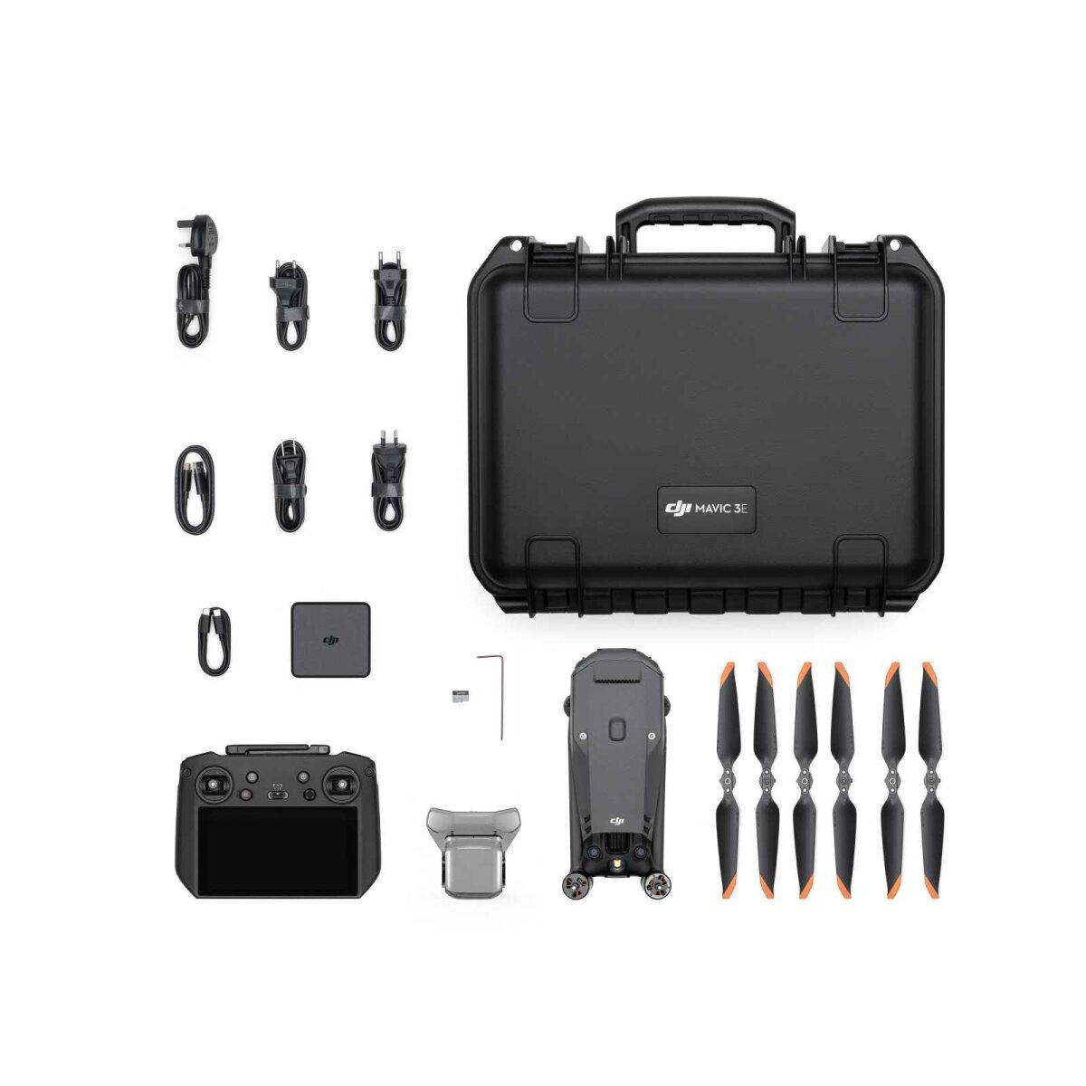
Included:
1x Mavic 3E aircraft
1x Mavic 3 Intelligent Flight Battery
1x MicroSD card 64GB
1x gimbal protector
3x Mavic 3 Enterprise Propellers (pair)
1x DJI RC Pro Enterprise
1x screwdriver
1x DJI USB‑C power adapter (100W)
1x AC cable for 100W power supply
1x USB‑C cable
1x USB‑C to USB‑C cable
1x hard case
3‑month trial licenseof the DJI Terra software included!
Product safety
Manufacturer:
SZ DJI Technology Co., Ltd.
14th Floor, West Wing,
Skyworth Semiconductor Design Building, No. 18
Gaoxin South 4th Ave,
Nanshan District, Shenzhen,
518057 China
Tel.: +86–755–266–566–77
Web: dji.com
E‑Mail: support@dji.com
Responsible economic operator in the EU:
Globe Flight GmbH
Borsigstrasse 7,
93092 Barbing,
Germany
Tel.: +49 (0)9401 — 949 88 88
Web: globe-flight.de
E‑Mail: info@globe-flight.de


