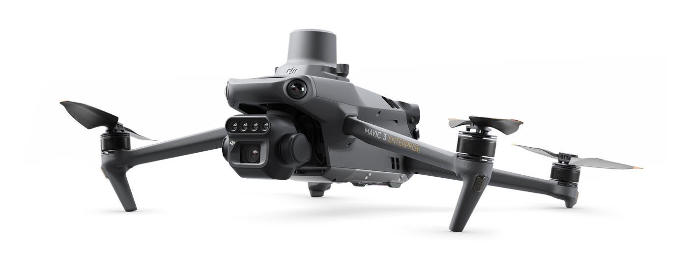
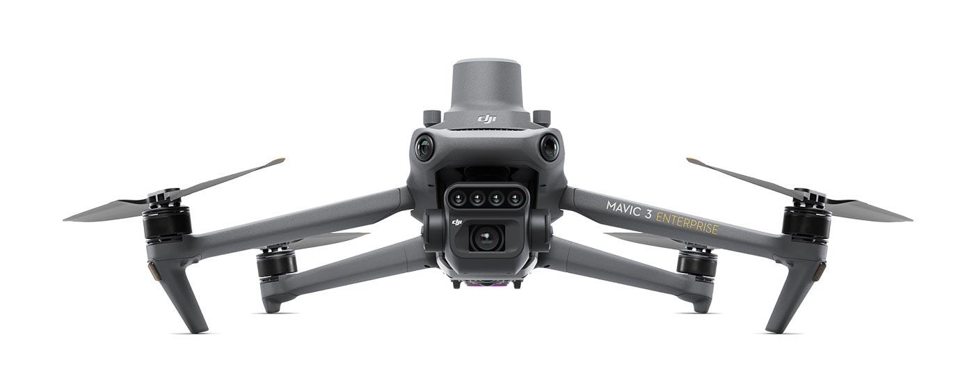
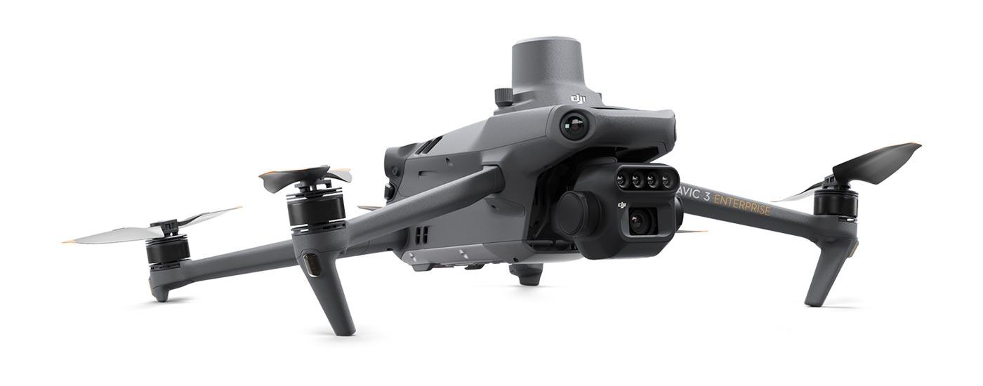
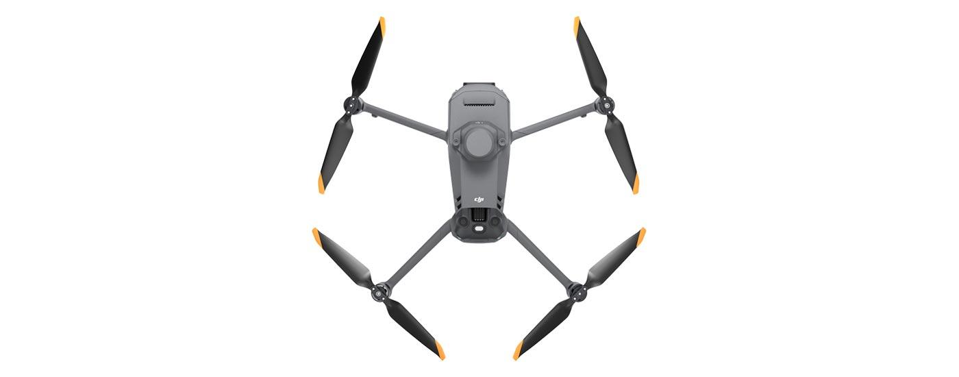
DJI Mavic 3 multispectral camera (incl. 12 months DJI Care Enterprise Basic, 1x maintenance)
Category: Drones
DJI Mavic 3M
Enterprise Series / Industrial Drones
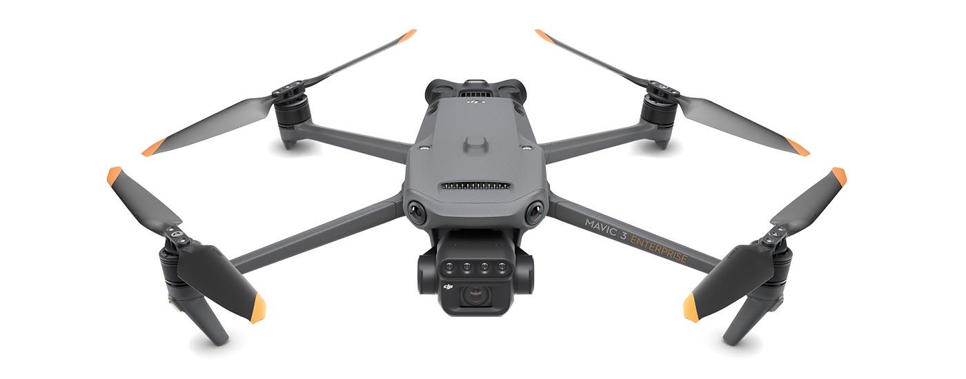
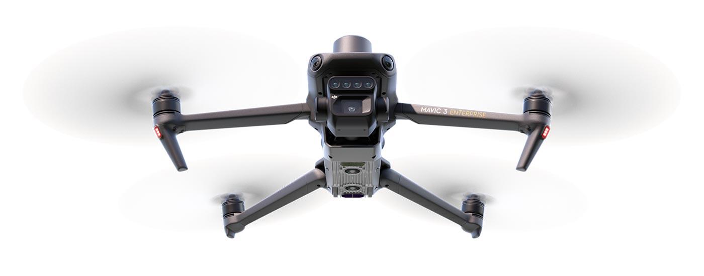
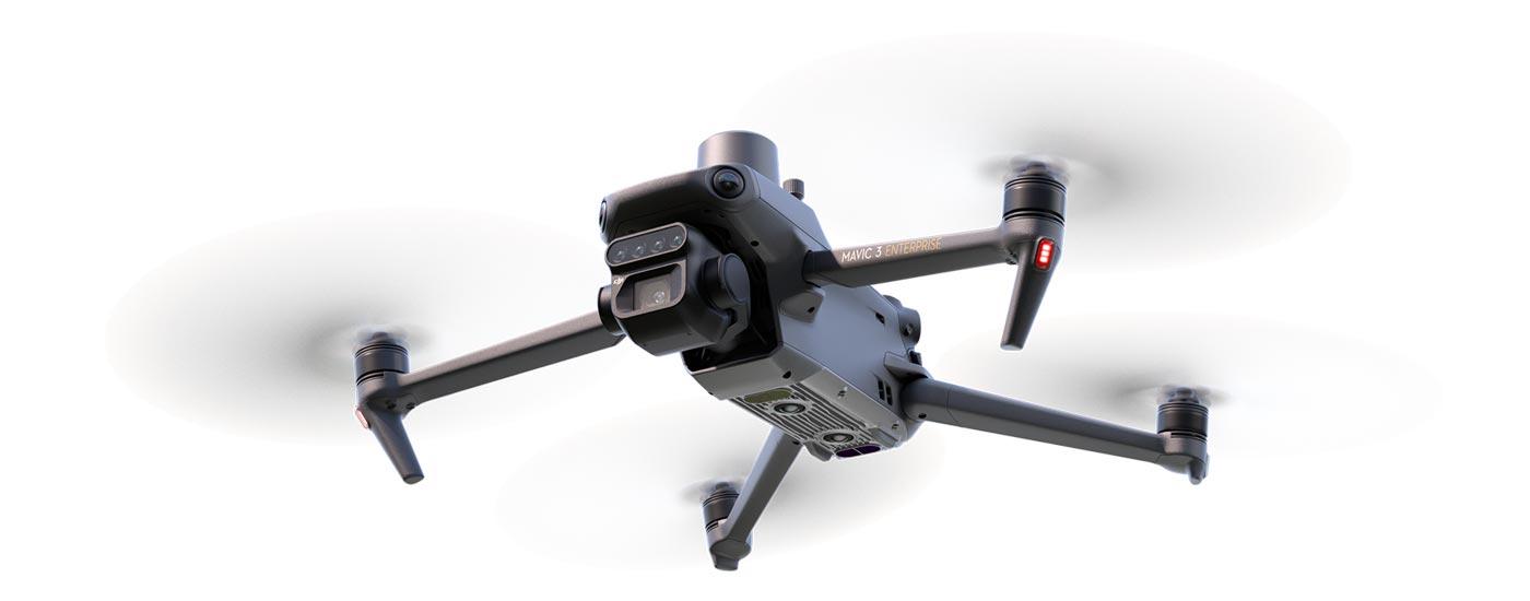
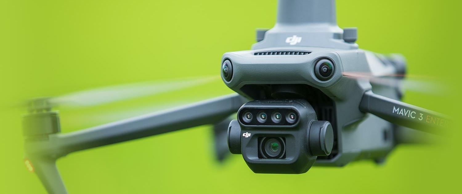
Effective aerial surveying needs to be able to see the invisible. That’s why the Mavic 3 Multispectral has multiple cameras to give you multiple views. It combines an RGB camera with a multispectral camera to scan and analyse crop growth with absolute precision. Precision agriculture requires relevant detail and data, and the Mavic 3M delivers both.
Price: 4.448,00 €
Prices incl. VAT plus shipping costs
Do you have questions about this item or would you like to order it?
Key Features
- 4x high-resolution 5MP narrow-band sensors for the areas of red / green / red edge and near-infrared
- RGB camera with 4/3″ CMOS sensor and mechanical shutter
- Integrated sunlight sensor
Possible areas of application
- Determination of plant health and growth or biomass determination
- Creation of application maps, index maps such as NDVI and intelligent field analysis with DJI SmartFarm
- Survey
Compact and handy
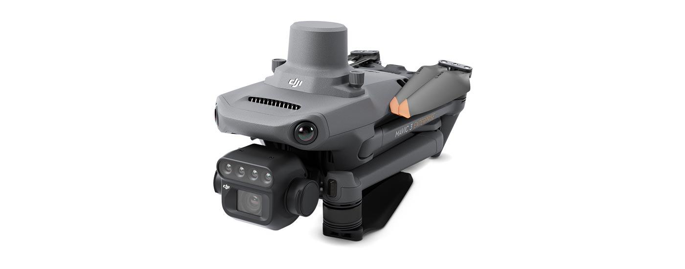
Foldable for easy storage
Multispectral camera
4 × 5 MP
G/R/RE/NIR
RGB camera
20 MP
4/3 CMOS, mechanical shutter
Safe and stable
Omni-directional obstacle avoidance
15 km transmission range
Precise positioning
RTK positioning accurate to the centimetre
Time synchronisation accurate to the microsecond
Efficient air measurement
Up to 200 hectares per flight
Highly integrated image processing system
New, improved image processing system with one 20 MP RGB camera and four 5 MP multispectral cameras (green, red, red edge and near infrared). Enables applications such as high-precision aerial surveying, plant growth monitoring and natural resource surveying.
Sunlight sensor
The integrated sunlight sensor detects solar radiation and records it in an image file, allowing light compensation of image data during 2D reconstruction. This leads to more accurate NDVI results as well as improved accuracy and consistency of data collected over time.
RTK module — Precise images that capture every pixel
Mavic 3M with RTK module for centimetre-precise positioning. The flight control, camera and RTK module are synchronised in microseconds to always accurately determine the position of the image centre of each camera shot. This enables the Mavic 3M to perform high-precision aerial surveying without control points.
Efficient and reliable battery life
Ultra-long battery life, fast continuous shooting
43 minutes
flight time
200 hectares
A single flight can conduct mapping missions over an area of 200 hectares.
Omni-directional obstacle avoidance,
terrain-following aerial survey
The aircraft has multiple wide-angle vision sensors that accurately detect obstacles in all directions for omni-directional obstacle avoidance. Terrain-following aerial surveying can be easily performed in landscapes with steep slopes.
Fast charging
Battery charging station (100 W)
Highly efficient fast charge capability
Fast charging with 88W
aircraft
Near Infrared (NIR)
860nm ± 26nm
Red Edge (RE)
730nm ± 16nm
Red ®
650nm ± 16nm
Green (G)
560nm ± 16nm
RGB camera features
4/3 CMOS
20 MP camera sensor
1/2,000s
Fastest mechanical shutter speed
0.7s
High-speed continuous shooting when using the RGB camera
Sunlight sensor
The integrated sunlight sensor captures solar radiation and records it in an image file, enabling light compensation of image data during 2D reconstruction. This leads to more accurate NDVI results as well as improved accuracy and consistency of data collected over time.
Orchard mapping
The Mavic 3M enables terrain-following aerial surveys of orchards, even in landscapes with slopes. Together with the DJI Terra or DJI SmartFarm platforms, you can reconstruct high-resolution maps of orchards, automatically detect the number of trees, distinguish trees from other obstacles or objects, and create three-dimensional flight routes for agricultural drones to make operations safer and more efficient.
- Mavic 3M Air Survey
- Mapping with DJI Terra / DJI SmartFarm
- Generate 3D routes
- Agricultural drone operations
Guide variable applications
For rice fertilization, cotton growth regulation and potato foliar fertilizer spraying, the Mavic 3M is used to obtain multispectral images of crops. DJI Terra or DJI SmartFarm [6] can then generate maps with NDVI and other vegetation indices, capture differences in crop potential, and create application maps that enable farming drones to run variable applications. Ultimately, this enables farmers to reduce costs, increase yields and protect the environment.
- Mavic 3M Air Survey
- Mapping with DJI Terra / DJI SmartFarm
- Generates application maps for farmland
- Agricultural drone
Intelligent field analysis
The Mavic 3M can perform automatic field analysis. The field analysis images can be uploaded to the DJI SmartFarm in real time via a 4G network. It can detect anomalies such as pest infestations, weed growth and deficits in plant development at an early stage. It can also perform intelligent analysis, e.g. B. Identifying cotton seedlings and testing rice production, enabling AI identification for real-time sharing of plant growth information, guiding agronomic activities, and easily managing 70 hectares of farmland by one person.
General technical data:
Aircraft
| Dead weight (with propeller and RTK module) | 951g |
| Max. Starting Weight | 1,050g |
| Diagonal Length | 380.1mm |
| Max. rate of climb | 6 m/s (normal mode) 8 m/s (sport mode) |
| Max. rate of descent | 6 m/s (normal mode) 6 m/s (sport mode) |
| Maximum speed (NHN, no wind) | 15 m/s (normal mode) Forward: 21 m/s, Side: 20 m/s, Back: 19 m/s (Sport mode) |
| Wind Resistance | 12 m/s |
| Max. Start altitude above NHN | 6,000 m (without payload) |
| Max. Flight time (if there is no wind) | 43 minutes |
| Max. Hover time (when there is no wind) | 37 minutes |
| Max. Flight distance | 32km |
| Max. pitch angle | 30° (normal mode) 35° (sport mode) |
| Max. Angular Velocity | 200°/s |
| GNSS | GPS + Galileo + BeiDou + GLONASS (GLONASS is only supported if the RTK module is enabled) |
| Hover Accuracy | Vertical: ±0.1 m (with vision positioning); ±0.5 m (with GNSS positioning); ±0.1m (with D‑RTK) Horizontal: ±0.3 m (with sight positioning); ±0.5 m (with HD positioning); ±0.1m (with RTK) |
| Operating Temperature | -10°C to 40°C |
| Internal Storage | - |
| Engine model number | 2008 |
| Propeller type number | 9453F Enterprise Edition |
| Light Sensor | Integrated module |
RGB camera
| Camera sensor | 4/3 CMOS, effective pixels: 20 MP |
| Lens | Field of View: 84° Equivalent focal length: 24mm Aperture: f/2.8 to f/11 Focus: 1m to ∞ |
| ISO | 100 to 6400 |
| shutter speed | Electronic shutter: 8 to 1/8000 s Mechanical shutter: 8 to 1/2,000 s |
| Max. Image Size | 5280×3956 |
| Photo modes | Single shot: 20MP Time Lapse: 20MP JPEG: 0.7/1/2/3/5/7/10/15/20/30/60s JPEG + RAW: 3/5/7/10/15/20/30/60s Panorama: 20 MP (original footage) |
| Video Resolution | H.264: 4K: 3840×2160 at 30 fps FHD: 1920×1080 at 30 fps |
| Max. Video Bitrate | 4K: 130Mbps FHD: 70Mbps |
| Supported file systems | exFAT |
| image format | JPEG/DNG (RAW) |
| Video Format | MP4 (MPEG‑4 AVC/H.264) |
Multispectral Camera
| Camera sensor | 1/2.8″ CMOS, effective pixels: 5 MP |
| Lens | Field of View: 73.91° (61.2° x 48.10°) Equivalent focal length: 25mm Aperture: f/2.0 Focus: Prime |
| Multispectral Camera Band | Green (G): 560 ±16 nm; Red ®: 650 ±16 nm; Red Edge (RE): 730 ±16nm; Near Infrared (NIR): 860 ±26 nm; |
| Gain range | 1x to 32x |
| shutter speed | Electronic shutter: 1/30 to 1/12800 s |
| Max. Image Size | 2592×1944 |
| image format | TIFF |
| Video Format | MP4 (MPEG‑4 AVC/H.264) |
| Photo modes | Single shot: 5 MP Time Lapse: 5MP TIFF: 2/3/5/7/10/15/20/30/60s |
| Video Resolution | H.264 FHD: 1920×1080 at 30 fps Video content: NDVI/GNDVI/NDRE |
| Max. Video Bitrate | Stream: 60 MBit/s |
Gimbal
| Stabilization System | 3‑axis motorized gimbal (tilt, roll, pan) |
| Mechanical Area | Tilt: ‑135° to 45° Roll: ‑45° to 45° Pan: ‑27° to 27° |
| Controllable Area | Tilt: ‑90° to 35° Pan: Uncontrollable |
| Max. Steer Speed (Tilt) | 100°/s |
| Angular vibration range | ±0.007° |
Battery
| Memory Capacity | 5,000mAh |
| Default Voltage | 15.4V |
| Max. charging voltage | 17.6V |
| Battery type | LiPo 4S |
| Chemical composition | Lithium Cobalt |
| Energy | 77 watt hours |
| Weight | 335.5g |
| Charge Temperature | 5°C to 40°C |
Included in delivery:
1x Mavic 3M Flight Device
1x Mavic 3 Intelligent Flight Battery
1x RTK module
1x MicroSD card 64GB
1x Gimbal protection
3x Mavic 3 Enterprise Propeller (pair)
1x DJI RC Pro Enterprise
1x Screwdriver
1x DJI USB‑C power adapter (100W)
1x AC cable for 100W power supply
1x USB‑C cable
1x USB‑C to USB‑C cable
1x hard case
3‑month trial licence for DJI Terra Pro software included!
12-month license for DJI SmartFarm platform included!
Product safety
Manufacturer:
SZ DJI Technology Co., Ltd.
14th Floor, West Wing,
Skyworth Semiconductor Design Building, No. 18
Gaoxin South 4th Ave,
Nanshan District, Shenzhen,
518057 China
Tel.: +86 755 266 566 77
Web: dji.com
E‑Mail: support@dji.com
Responsible economic operator in the EU:
Globe Flight GmbH
Borsigstrasse 7,
93092 Barbing,
Germany
Tel.: +49 9401 949 88 88
Web: globe-flight.de
E‑Mail: info@globe-flight.de

